Alabama’s severe weather risk increases for overnight hours
Published 3:44 pm Monday, January 8, 2024
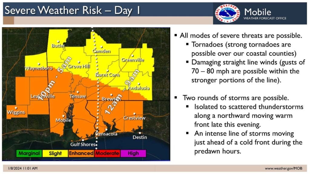
- Severe weather is forecast for late tonight into the early morning hours on Tuesday. Wind and storms will then follow ahead of a cold front moving from west to east across the state. According to the National Weather Service, tornadoes are possible. Photo courtesy of Crenshaw County EMA.
By Haley Mitchell Godwin
The impending risk for severe weather in the area has increased to a level three out of five, an enhanced risk.
Widespread soaking rain will move in after 4 p.m. and the winds will begin to pick up around this time as well. According to the National Weather Service (NWS) in Mobile, the wind will continue to get stronger throughout the evening and severe weather can be expected in our area between midnight tonight and 9 a.m.Tuesday morning.
There is a risk of tornadoes and damaging straight-line winds with gusts of 70-80 MPH possible.
According to NWS, strong tornadoes, EF-2 or stronger, can’t be ruled out. Multiple rounds of storms are expected along with dangerous lightning.
Elliott H. Jones, Crenshaw County Emergency Management Agency director, asks that citizens remain weather aware.
“We must remain weather-alert and weather-ready tonight and especially during the early morning hours,” Jones said.
“It is tornado season here in the south, which starts in November and runs through May. If any of our citizens would like tips or guidance on better preparation, they are always welcome to stop by the office located at 118 East 3rd St., reach out to us on social media or call us at 334-335-4538 or 334-508-2434.”
Two to four inches of total rain is expected with some locally higher amounts and there is a slight risk of localized flooding. Rain will last through the evening and overnight with the rain ending by noon tomorrow.
For updates on weather conditions for Crenshaw County visit the National Weather Service website at weather.gov/bmx and follow Crenshaw County EMA on Facebook.


