Crenshaw County EMA Director UPDATE
Published 8:53 pm Thursday, June 17, 2021
Provided by Elliot Jones, Crenshaw County EMA director:
Although we don’t expect severe weather to be a significant threat for our County as of now, we will be receiving an abundance of rain over the next several days. The following is the latest update from the NWS.
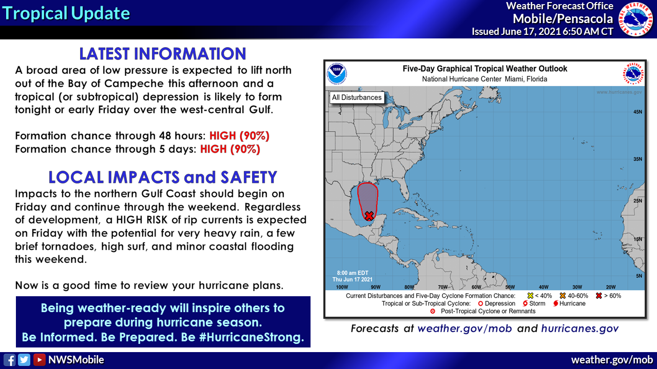
We continue to closely monitor the potential for tropical development in the western Gulf of Mexico. A broad area of low pressure over the southwestern Gulf of Mexico is expected to move northward over the next couple of days, and a tropical or sub-tropical depression is likely to form over the west-central Gulf tonight or early Friday. This disturbance currently has a HIGH Chance (90%) of becoming a tropical (or sub-tropical) cyclone. An Air Force reconnaissance aircraft is scheduled to investigate the disturbance this afternoon. (Ambien)
Guidance has continued to come into better agreement bringing this storm northward towards the northwest or north central Gulf coast. However, the storm is expected to be lopsided with most of the impacts occurring east of the center. Regardless of track or strength, a HIGH RISK of rip currents and high surf is expected by Friday and will continue through the weekend. There will be a potential for minor coastal flooding as well. A primary concern is the potential for very heavy rainfall and possible associated flash flooding and also possible severe weather including tornadoes over the weekend.
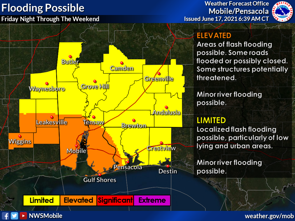
Below are the most likely impacts for our local area:
- Possible Impact #1:
- WHAT? Dangerous Rip Currents and High Surf is becoming increasingly likely. A High Risk of Rip Currents and a High Surf Advisory has been issued.
- WHERE? Local area beaches of coastal Alabama and the western Florida Panhandle.
- WHEN? Beginning Friday morning and continuing through the weekend.
- Possible Impact #2:
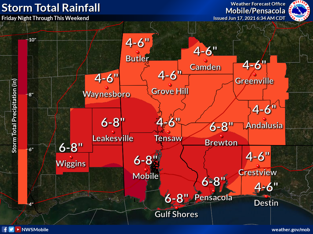
- WHAT? Heavy Rainfall and Flash Flooding is possible. 5 to 9 inches with locally higher amounts possible.
- WHERE? The entire area, but especially southeast Mississippi and southwest Alabama. Potential also there for south central Alabama and the western Florida Panhandle.
- WHEN? Beginning Friday night and continuing through the weekend.
- Possible Impact #3:
- WHAT? Severe storms with a tornado or two possible.
- WHERE? Across the entire area with best chances likely west of I-65.
- WHEN? This weekend, especially on Saturday and Saturday night.
- Possible Impact #4:
- WHAT? Minor Coastal Flooding remains possible. With the potential for 1 to 3 feet of water above normally dry ground possible.
- WHERE? Along the coast, especially in the normally minor flood prone locations.
- WHEN? Saturday and Sunday.
We will continue to provide additional updates over the next several days.


